|
|
|
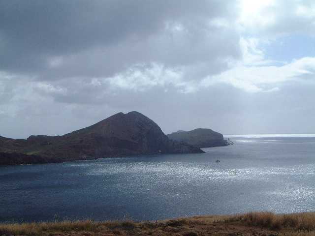
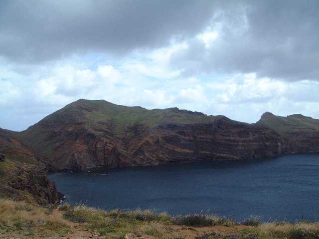
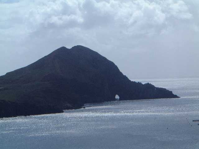
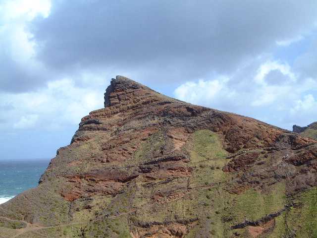
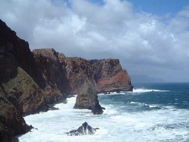
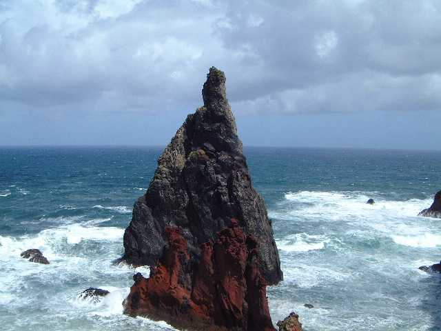
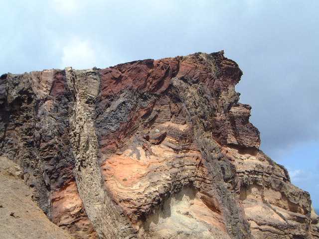
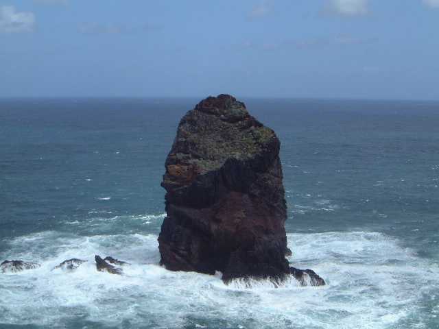
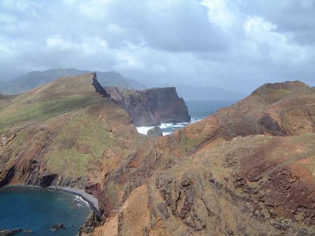
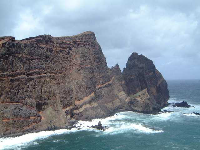
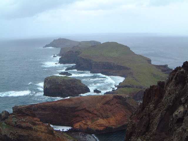
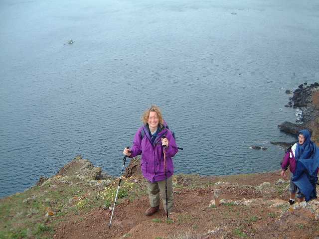
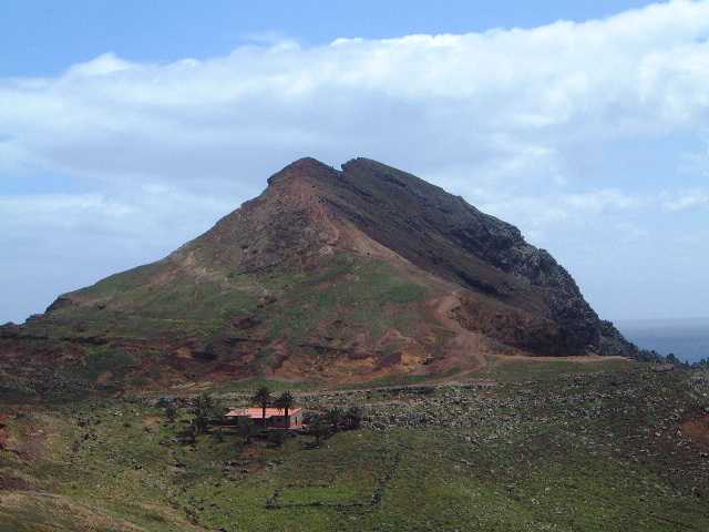
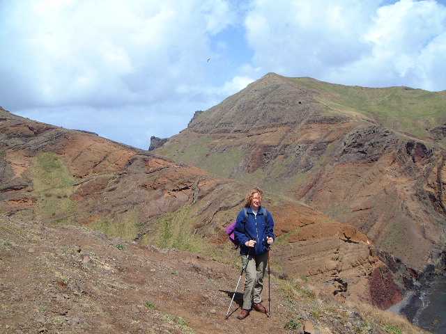
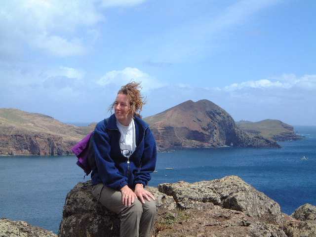
In one way this was a very disappointing day. We were supposed to be going to walk the ridge from Pico Arieiro (where we had been briefly on Wednesday) to Pico Ruivo, the highest point on Madeira. It seems quite an exciting walk from the route description I had read. However the cloud was down on top, there was rain about and the temperature was 1 degree Centigrade. So the guides aborted the walk. Looking at the gear being sported by some of the group this seemed very sensible. The walk they were offering instead seemed a poor substitute from the description in the Turivema leaflet. This document had seemed to oversell all the walks. Strangely it erred in the opposite direction for this walk, not doing it anything like justice. We went to the far eastern end of the island. Here there is a long peninsula out to Ponta Sao Lourenco.We parked at the end of the road where the omens were not good - a large car park with dusty tracks off. However we were soon into the most stunning coastal scenery with tricky paths linking up giant cliff views. Reading the book of walks that evening, it simply said that this is one of the must-do walks of Madeira. I'll drink to that. Basically the walk took us around Baia da Abra. This is on the southern side of the peninsula. The sun was out, the sea was shining and we stared out in admiration at the arch at the far end of the bay. Sadly we never got quite close enough to it to get really good photos. The path was going up and down but it was only when we reached the northern coast that we saw the true glory of the peninsula. The cliffs here take the full impact of the Atlantic driven in by the prevailing winds. There are higher cliffs in Madeira (indeed it boasts the highest sea cliff in Europe) but I didn't see any as spectacular. Rock stacks abound, one set called the Seahorses being the best. The layering of the rock is all too evident with darker stripes of basalt within it. All of Madeira is volcanic but the basalt is from a later era as lava forced its way up through dikes in the already-formed volcano. The path then comes to a distinctly interesting section; it is marked as Estreito on my map. The land narrows to a neck and the path goes across the ridge with sharp drops on both sides. In fairness, it isn't as narrow as Crib Goch and there is a handrail in the worst bits but it did get the pulse racing. You then enter something of a meadow as the vegetation becomes lusher. It is fed by water being pumped up from the only spring on the peninsula. There is a house at the far end which is used by the ranger service. Unfortunately it doesn't have toilets. Several bladders were straining (including mine as ever) and cover is non-existant here. You just had to be less circumspect than normal to obtain relief. As compensation for missing the mountains we were allowed to climb the hill at the far end and there was quite a scramble to the second top. this is the end of the island. The sea has broken though the land in the next col so that beyond is a series of islets. The views are quite something from here. We returned to the house, looped round the opposite side of the meadow (this included the option of a swim which was rejected unanimously) and then back the way we had come. Only about 6 miles but really memorable
|
|